Empowering Next-Generation Public Works with GIS: Insights from the Esri Seminar in Houston, TX.
Leveraging ArcGIS Solutions to Enhance Resilience, Transparency, and Operational Efficiency in City Infrastructure
Introduction: The Urgency of Infrastructure Modernization
The 2025 ASCE Infrastructure Report Card paints a sobering picture of America’s public infrastructure. With grades ranging from D to C across critical sectors like roads, transit, water, and wastewater, the message is clear: we must modernize how public works are managed. At the recent Esri Public Works Seminar in Houston, leaders from across the region explored how GIS (Geographic Information Systems) is transforming operations, planning, and emergency response for cities and counties.
Challenges in Parks, Grounds, and Emergency Management
Municipal departments are increasingly facing mounting challenges:
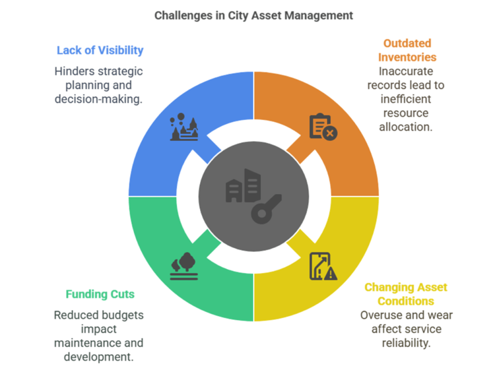
GIS empowers these agencies with real-time dashboards, field collection tools, and integrated operations platforms to manage these assets more proactively and effectively.
Case Study Highlights: Field Operations in Action
One standout example came from Fort Lauderdale, Florida, where GIS supported rapid response to flash flood emergencies. Using ArcGIS Dashboards, Field Maps, and the Workforce App:
- Crews tracked real-time damage assessments
- Field staff used mobile apps to collect photos and classify damage
- The command center made data-driven decisions to allocate resources
This integrated response showcases how Esri’s tools improve coordination, resilience, and service delivery.
Debris Management: A Pillar of Disaster Resilience
Disaster resilience begins with efficient debris management. The Emergency Debris Management Center, powered by ArcGIS Experience Builder and the Workforce app, helps cities:
- Assign and track clearance tasks
- Prioritize based on criticality
- Visualize crew progress across the city
Baltimore County's deployment showed how these tools enable fast recovery and ensure public safety after major weather events.
The Value of ArcGIS for Public Works
Key takeaways from the seminar underscore GIS’s transformative potential:
- ArcGIS is scalable and supports the full spectrum of public works functions.
- It's a gateway for integrating advanced technologies like AI, IoT, and LLMs.
- The most sustainable way to grow GIS capabilities is through Esri’s ready-to-use solutions.

Whether for asset management, capital projects, permitting, or citizen engagement, ArcGIS provides a unified platform to manage data, workflows, and decisions.
GIS Enables Next-Generation Public Works
The seminar concluded with a vision of how GIS is enabling the future of public infrastructure by helping cities:
With tools like ArcGIS Experience Builder, Dashboards, Field Maps, and Workforce, agencies can proactively manage resources, respond to challenges, and plan for sustainable growth.
Conclusion: Modernize with GIS to Build Resilient Communities
As public works departments face increasing demands and limited resources, GIS offers a strategic advantage. The Esri Public Works Seminar in Houston showcased how modern tools can transform public infrastructure management. Cities that embrace GIS are not just managing assets better they are creating safer, smarter, and more resilient communities.
For more information or to start your GIS modernization journey, visit Esri Public Works Solutions.
A heartfelt thank you to Adam Carnow, Robyn Garrett , Muhammad “Moe” Abdullah andfrom the Esri team for organizing an outstanding Public Works GIS Workshop. The sessions were both inspiring and practical, demonstrating how GIS is shaping the future of resilient, transparent, and efficient public infrastructure.
At iSpatial Techno Solutions (IST), as a Esri Gold Partner we are proud to reaffirm our commitment to working closely with Esri to deliver smart, impactful, and sustainable solutions for cities and communities. Together, through strategic collaboration and innovative GIS applications, we can create measurable impact, enhance public services, and drive digital transformation across the public works sector.
Let’s continue this journey of innovation—together, we can make a difference.
Thanks & Regards,
Vattem Narendra Babu - CEO
iSpatial Techno Solutions Inc.